Trail Route Notices and Alerts
Storm damage, road construction, you name it. Check here for updates on temporary changes or impacts to plan around along the Cross Vermont Trail route. Use this information in addition to the information in our maps and cue sheets.
Sand, and other flooding impacts, in Waterbury.
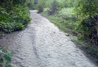
The "green path" behind the Waterbury State Office Complex - especially the part around the cornfield, between the office buildings and Hope Cemetery - has a lot of sand on the trail. This was deposited by the floods of the last couple years. We are looking at expedient measures to take in the short term to make a more useable treadway through here.
Long term there may be some major flood remediation work done at this site, to make the flood plain more available to the river in future storms. Stay tuned for updates as to how the trail may be adjusted in the future as a part of these larger efforts.
Slumping again along Route 2 in East Montpelier.
A short section of the trail alongside Route 2 in East Montpelier has an ongoing slump, initially triggered by the July 2023 storm.
CVTA is working to keep this spot patched and open for use in the short term.
Long term VTrans is planning a larger project to support the road here (and by extension the trail.) Until further notice from VTrans, this is still a long term goal with no specific timeline attached.
Road closure in South Ryegate on Cross Vt Trail route.
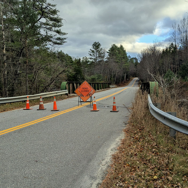
Bridge on Creamery Rd near east junction with Rte 302 closed indefinitely.
In October of 2025 a bridge over the Wells River on Creamery Road in South Ryegate was deemed by VTrans inspectors to be unsafe for use. This is the one at the east end of Creamery Rd, just before the road intersects with Route 302. This bridge has been on a watch list for replacement for many years, but funding has not been available. Now it is closed until funding can be secured for replacement, which may be some time.
For the Cross Vermont Trail route, this means staying on the shoulder of Route 302 through South Ryegate, instead of winding through the village on Creamery Rd.
Read the full story and interesting history of this bridge in a Journal Opinion article.

Beavers repurpose railbed as dam.
(Ongoing issues.)
We can't fault them for repurposing the railbed, that'd be the pot calling the kettle black. At various times, it ebbs and flows, beavers will block culverts under the old railbed and use it as a dam to make their pond. Sometimes they (busily) build their dams up taller than the old bed, and water spills over onto the trail making large puddles. It's dramatic and cool to see. Many people can just splash through. However, it does make the going more difficult. Periodically this happens in the Wells River Conservation area behind Blue Mountain Union, and in Groton State Forest west of Lanesboro. This notice affects Maps 1 and 3.