Maps and Guide
Explore trails, parks and communities across Vermont, following the Wells River and the Winooski River. Cross Vermont Trail is a project to build a new trail spanning the state from the Connecticut River to Lake Champlain. We are celebrating local trails and working to improve and extend them with the ultimate goal of a connected statewide network. Meanwhile, we highlight the best available local roads that can be used to join local trails to make longer trips.
The trail is mapped here in Google Maps and also on paper, which you can view below or download as pdf. Scroll down for links to additional information as well. Have a good trip and tell us how it goes!
Maps
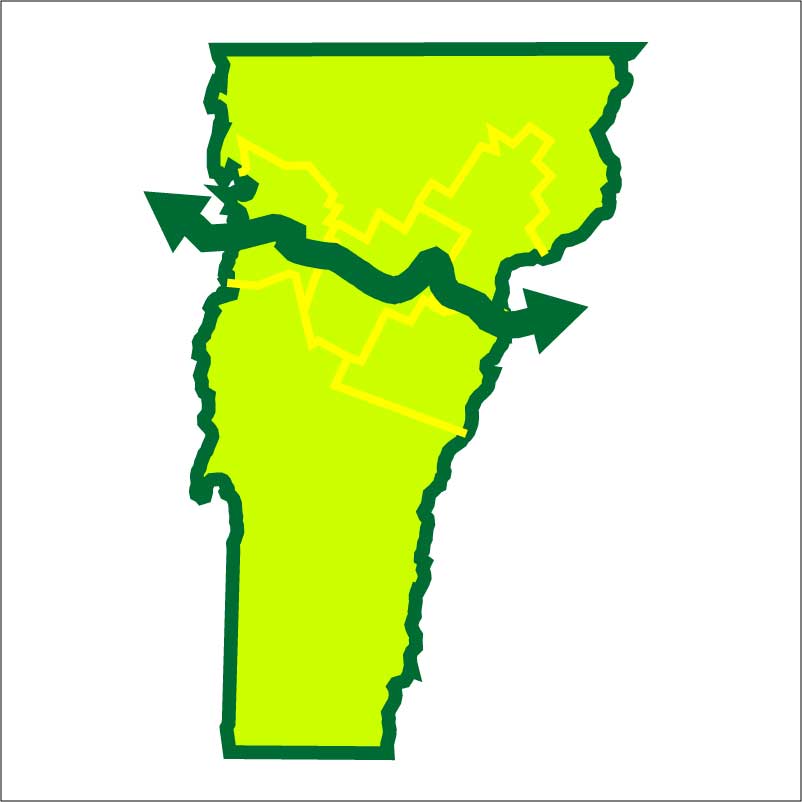
The Cross Vermont Trail Statewide Map
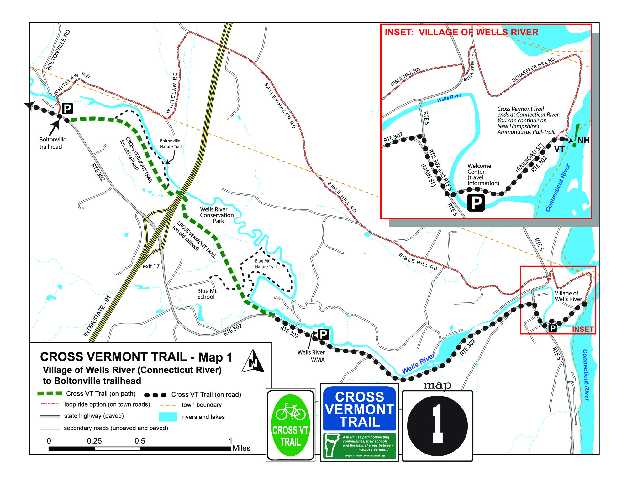
The complete route is described in 15 maps showing local details, trail segments, trailheads and parking, and other features.
Each map shows open sections of trail, and highlights roads that can be used to link them together to make longer trips. (The route is shown in the context of a larger street map of the area in order to help the reader orient to the trail location.) A "cue sheet" accompanies each map with brief turn by turn directions (two versions of each cue sheet, one written east to west and then a mirror version written west to east).
The Cross Vermont Trail route is a little over 90 miles (the width of Vermont!). Currently about half is on bike paths, rail trails and quiet country roads. But the other half is still on busier roads. Lets fix that. We are a small non-profit organization, member based and volunteer driven, working to build more trail with the goal of a complete statewide off road route. You can help!
Click here to view descriptions of each trail section and all the maps in a scroll of jpg images.
Download complete statewide map set as a single PDF (37 pages, letter size).
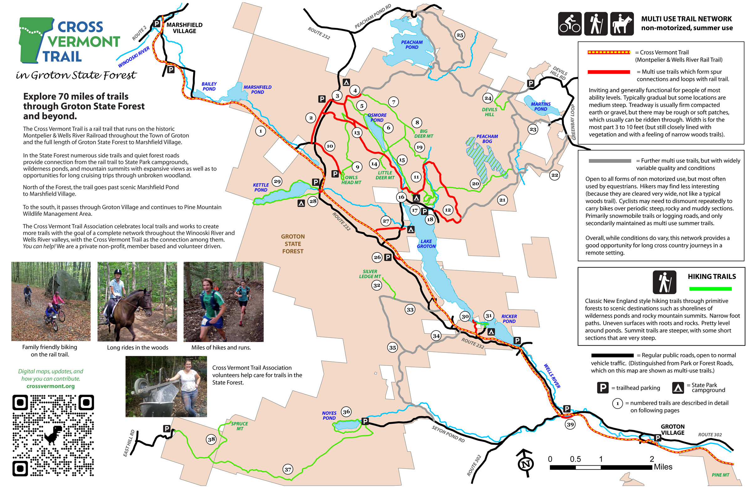
Groton State Forest (and beyond!) Trail Guide
Over 70 miles of trails and quiet forest roads in Groton including throughout the State Forest and then all the way across Town of Groton and up to Marshfield Village as well. Spurs and looops off of the Cross Vermont Trail provide access to wilderness ponds, rocky mountain summits, campgrounds and village centers.
This map names and describes all the trails which are connected by the Cross Vermont Trail in the Groton area. With close ups to untangle how the trails all relate to each other.
Click here to view maps as a scroll of jpg images.

Download Groton State Forest (and beyond!) Trail Guide as PDF (6 pages; 11x17 size).
Notices and Alerts
Road Rules and Trail Etiquette
Recommendations for safely walking and biking on roads
About half of the Cross Vermont Trail statewide route is currently on roads. We are working to make a complete trail in the long term. But for now people following the trail route need to be prepared to safely walk or bike on automobile roads.
Click here for summary of safe on-road travel advice.
Sharing the trail with multiple types of users
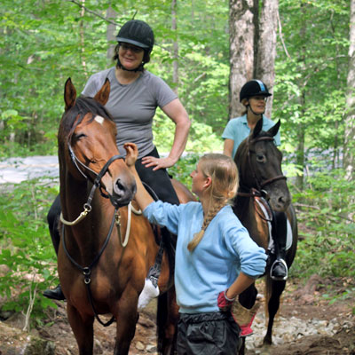
All trail portions of the Cross Vermont route are open to many different types of users (and their little dogs too.) We observe that people out on trails are a pretty positive bunch. But in addition to this common courtesy, there are some standard polite protocols that are good to know about.
Click here for summary of trail etiquette tips.
About the Trail Route
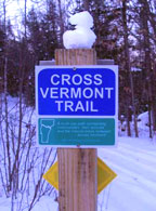
Signs and seeing which way to go
Navigate the route by combining signs with maps, cue sheets, and written guide material. There are hundreds of signs statewide, but also long stretches between them. It may be difficult to follow the route using signs as the only source of information.
Click here for decoding types of signs and advice on finding the route.
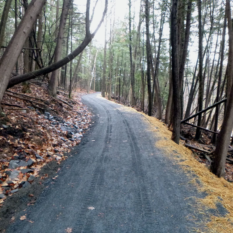
Paved? Gravel? Grass? The character of the trail
The statewide Cross Vt Trail is a patchwork quilt being stitched together from many local paths and local roads. The surface and nature of "where the rubber meets the road" varies widely. But our goal is always to be open to regular people with regular equipment.
Click here for a breakdown of different conditions to expect on the route.

Big picture, where is the trail and why
The Cross Vermont Trail route may seem a bit jumbled, and put together from disparate parts. But there is a logic to it. At least we feel there is. Following these two river valleys, saving an old railroad corridor, providing convenient access to nature near where people live and safe off road travel to desired destinations. It sort of makes sense!
Click here for the big picture thinking about the trail route.

Explore the broader history and landscape of the trail route
Look beneath the surface.
Learn more about the rivers that form the heart of the statewide route, the landscape around them, and the people who have lived here.
Click here to view a slideshow of interpretive story panels.
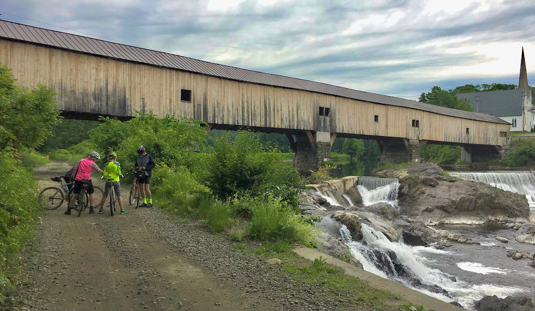
Finding Rail Trails

History of the Montpelier & Wells River Railroad
"Tracking the Bed." Following the trail today between Montpelier and Wells River is like a scavenger hunt for remnant pieces of an old railbed.
The Montpelier & Wells River Railroad ran until 1956. Today the Cross Vt Trail Association is working to save the old railbed as a trail where possible, and to build new trail where the railbed is not available, to make a new complete off road route.
Click here to read about how the trail is related to railroad history.
List of Rail Trails in Vermont
There are a number of rail trails in Vermont, large and small. Some are "railbanked" legal railroads that are managed by State Agency of Transportation as public rights-of-way. Others, like the Cross Vermont Trail route, are abandoned old railbeds that have been saved, at least portions of them, as trails by private efforts.
Click here for a description of rail trails in Vermont.

Bayley Hazen Connector
Connecting the Lamoille Valley Rail Trail and the Cross Vermont Trail.
The BHC - Bayley Hazen Connector - is an on road scenic route that connects the Cross Vt Trail (Montpelier & Wells River rail trail) and the Lamoille Valley Rail Trail. It runs from the XVT trailhead in Boltonville up to the LVRT trailhead at the old depot building in Danville; on town roads through Newbury, Ryegate, Barnet, Peacham and Danville.
Click here for map and information about the BHC (pdf).
And here for description of the full historic Bayley Hazen Rd (pdf).
Camping, lodging, services, shuttles.
Camping
Many people divide the trip across the state into three days, spending two nights at State Park campgrounds in Waterbury and in Groton State Forest.
In Waterbury, the State Campground is "Little River." It is a bit of a distance off of the Cross Vt Trail route, west along Route 2 from Waterbury Village.
In Groton State Forest there are three campgrounds with easy trail connections to the Cross Vt Trail - the campgrgounds are named New Discovery, Stillwater and Ricker Pond.
Click here for Vermont State Parks website.
Lodging, shuttles and other services
Hotels and Restaurants
There are numerous businesses along the trail route offering lodging, food and supplies. A safe bet is to just go to any downtown or village area and you will find most of what you may be looking for.
CVTA does not keep track of hotels, motels, bed and breakfasts and homeshares along the route. But this is a tourist area and there are many of these. If you have a good experience let us know and we'd be happy to pass the information along to other trail users who may inquire.
Shuttles and long term parking
At the eastern start of trail overnight parking is allowed at Railroad Park in downtown Woodsville, NH.
To the west in Burlington there are many parking options, though these may include fees.
CVTA does not keep track of who is currently offering shuttles to trail users. Providers sometimes advertise their services with other trail groups (contact Cross New Hampshire Adventure Trail or the Green Mountain Club for starters.) There are also various bus lines along the route, depending on where your trip is starting and ending. Ride share apps may also be useful. If you find a good provider, we'd be happy to hear about it and spread the word to other trail users who inquire.
Bike Care and Repair
Free bike maintenance stands for public use are located at the Groton Library in the Village of Groton and next to the Hunger Mt Coop (grocery store) on Stonecutters Way in Montpelier. Full service bike shops are located in downtown Montpelier, Barre and Burlington.
Don't Stop
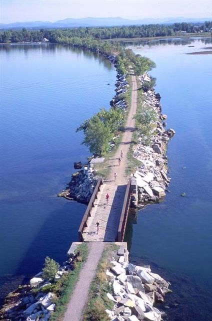
West to the Island Line Rail Trail and Champlain Bikeways
To the west, Cross Vermont route joins with Island Line Rail Trail and the larger Champlain Bikeways network, over 1,100 miles of mapped bike routes circumnavigating Lake Champlain through Vermont, New York, and Quebec.
Click here for more information at Local Motion Route Maps page.
East to Ammonoosuc Rail Trail and Cross New Hampshire Adventure Trail
To the east, just over the Connecticut River from Wells River, VT, is the Ammonoosuc Rail-Trail managed by New Hampshire Trails. The highway bridge over the Connecticut River has a separated sidewalk, so it is easy to go over to Woodsville and the trail there.
And beyond on the Cross New Hampshire Adventure Trail! Friends of the Cross Vt Trail in northern New Hampshire 'keep it going' - east from Wells River all the way across NH to Bethel Maine
Click here to go to the website of our sister trail in New Hampshire.
Partners and Peers
Organizations we work with
The Cross Vermont Trail is all about connections. The trail route is a collaboration of CVTA with many municipalities, state agencies, private landowners and fellow non-profit organizations. The goal is to leverage everybody's capacity so we can all get more done together than it would add up to each working separately. Good trick if you can pull it off! Give us a call if you have an idea about ways we can work together.
Click here to see a statewide list of organizations we partner with and links to their websites.