The story of the Montpelier & Wells River Railroad
Tracking the bed. From Montpelier to Wells River the route of the Cross Vermont Trail follows the same general route as the historic Montpelier & Wells River Railroad.
The Milk Run. Trains ran for 83 years - 1873 to 1956 - stopping in every village along the way with passenger service, mail delivery, to pick up milk and lumber and haul all manner of freight.
Following the trail today is like a scavenger hunt for remnant pieces of this old railbed. The railroad company went out of business in the 1950s and ownership of the railbed divided among many landowners. Today portions of the bed are open as a public trail, while other segments are simply private land, and some parts are gone forever lost to time and chance.
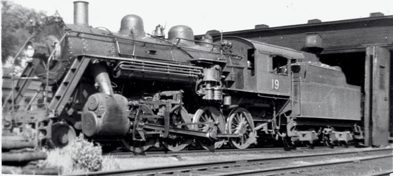
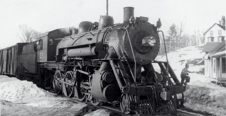
Montpelier & Wells River RR 2-8-0 #19, August 1941. Photo: Dwight Smith.
Pulling out of the shed on Stonecutters Way in Montpelier, poised for the run to Wells River. Let's Go!
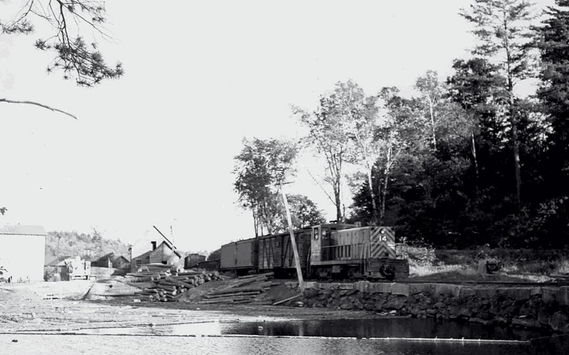
Making the run to Wells River
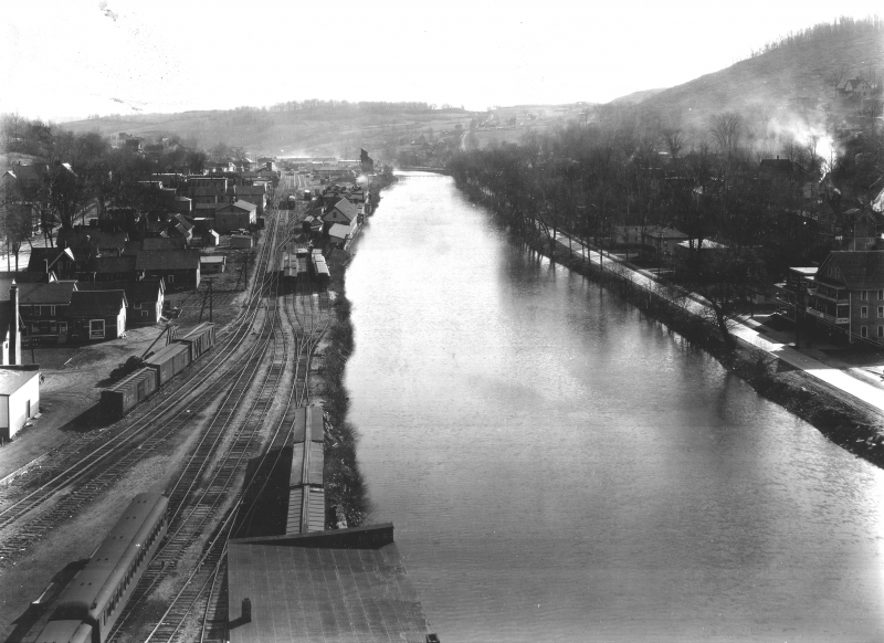
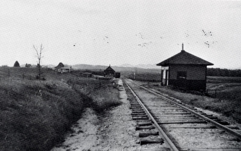
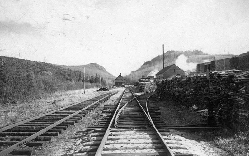
The extensive train yard where Stonecutters Way is now. Looking east from above Main Street. Photo: Vt History Society
Glimpses of railroad history along the Cross Vermont Trail route.
The Montpelier & Wells River Railroad (M&WR RR) started where Taylor Street is now in Montpelier. Because that's where the Central Vermont Railroad stopped. The Central Vermont was the main train across the state built in the mid 19th century (still running today.) It famously skipped coming to Montpelier and also Barre. The Central Vermont had a depot out where the train station is today, at Montpelier Junction west of the city. They did put in spur to Montpelier (and eventually to Barre and all the way to Williamstown, which is another story) but intially the spur went only to where the parking lot west of Taylor Street is today.
The M&WR RR was essentially built to keep that spur going - to connect both down to Barre and also across the State to Wells River. Barre was an important destination for both passengers and also freight, including the famous granite. Wells River was an important destination because in the 19th and early 20th century it was a train hub, with several railroads coming together from all directions and interchanging there.
The train depot for the M&WR RR was where the Shaws Grocery store is now. The maintenance sheds and railyards started there and eventually spread all along what is now Stonecutters Way. A remnant of this can be seen at Turn Table Park along the bike path. The owners of the railroad company had their offices in the brick building that still stands next to the tracks across from Shaws. They could gaze upon their little kingdom from high atop the third floor.
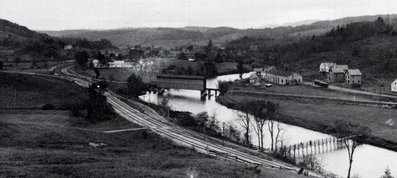
Barre Transfer in the early 1900s. This is where the tracks split with the main line going to Wells River and the spur going to Barre and the quarries. This photo is taken about where the bike path is today, across the river from where the round about at Rte 2/Rte 302 is now. The covered bridge is now a metal truss railroad bridge. Photo: Granite Railroads/Jones et al
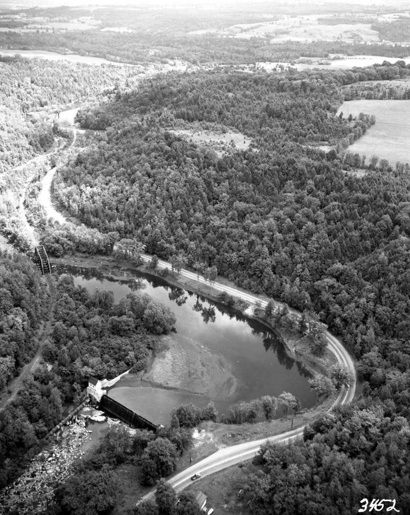
Looking upstream along the Winooski River with the hydrodam in the foreground (the same dam the trail goes by today just east of Gallison Hill Road.) This is the early 1960s but the old railroad bridge is still in place on left side of photo. The modern bike path bridge is in the same spot. Photo: Vt History Society
Fairmont Station. The East Montpelier depot, on Route 14, where the trailhead parking lot is today. Looking west. Photo: Granite Railroads/Jones et al
Barre Transfer
Today a set of operating railroad tracks still runs out along the Winooski upstream from Montpelier and then cuts south to parallel Route 302. The Montpelier Bike Path is built alongside these tracks as a "rail with trail" project. The location today of the roundabout intersection of Route 2 and Route 302 was for a long time known as "Barre Transfer". This is where the M&WR RR split into two with one line going south to Barre and the other line east to Wells River.
Across East Montpelier
Today the Cross Vermont Trail first gets onto the old railbed east of Galllison Hill Road at the Barnes Brook trailhead, also known as "Powerplant Rd". The railbed here is now an access road for a hydrodam as well as being open to the public as a trail. In railroad days the powerhouse for the dam was much closer to the main road. The water was carried from the dam to the powerhouse in a large pipe called a penstock. The remnants of the this can still be seen along the river on the Penstock Trail.
Bewtween the Winooski River bridge by the powerdam and Route 14 farther across East Montpelier CVTA is currently working to build a new trail to recreate the route of the old railbed. Once at Route 14 there is another section of old railbed that survives and is the trail. The East Montpelier train depot was located where the trailhead parking lot is now and was called "Fairmont Station".
High above Plainfield
The railroad approached Plainfield Village from the west high on the side of the hill, above where Rec Field Road is today. That section of the railbed is mostly returned to nature, lost to floods and mud slides over the years. When the trains got to the village they stayed at that elevated grade on tall causeways and several long bridges. These are long gone, but remants of the massive granite stone work can still be seen along village streets.
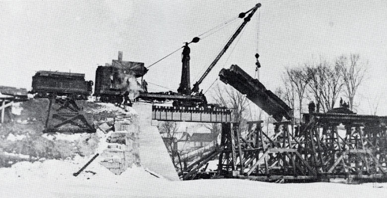
Replacing the bridge over Great Brook in Plainfield Village. The railroad traveled above the village on a tall causeway. These granite bridge abutments are still there, but the bridges are long gone. Photo: Granite Railroads/Jones et al
The Plainfield Depot, which is now the trailhead and the Park and Ride. The dirt road in foreground is Main Street. Standing on the hill across street from the Park and Ride looking northeast. Photo: Granite Railroads/Jones et al
The Plainfield Depot was where the Park and Ride is today. The railbed heading east from here is the Cross Vermont Trail for a short way, to John Fowler Road. Beyond that to Bemis Farm Road (uphill from Marshfield Village) much of the railbed still exists and can be seen. However, the ownership of this section of the railbed has split up among many different landowners, and it is not currently a continuous public trail. CVTA is working to find a way to make a trail that crosses Marshfield, either on the railbed or elsewhere as makes the most sense. But in the meantime, at John Fowler Road the official trail route bows out of the railbed and takes Route 2 to Marshfield Village.
Marshfield Depot. This is also now a trailhead and parking lot, just east of Bemis Farm Road. Looking east. Photo: Vt History Society
The long bit. Marshfield through Groton to South Ryegate.
The longest continuous stretch of trail on the railbed starts at Bemis Farm Road, near Marshfield Village. The trailhead parking lot here was once the Marshfield Depot. (You may be noticing a pattern. We don't exactly know why so many of the depot locations ended up being still publicly owned, when much of the rest of the railbed was sold or given away to private owners. It feels like there must be a story!)
On a map you can see that the railbed makes a long arcing loop up to Bemis Farm Road before descending back to the southeast past Bailey Pond and Marshfield Pond. Originally the railroad was going to make a straighter line, farther to the south away from the Village. But the good citizens of Marshfield refused to be left behind and they convinced the railroad to spend the extra money needed to bring the depot as close the village as possible.
Lanesboro looking east. This was a busy sawmill for many decades. Photo: Vt History Society
Rickers Mill with logs stacked up, 1953. At the south end of Rickers Pond, looking south. The train is rolling north through what is now the trailhead parking lot at the south edge of the State Forest. Photo: Dwight Smith
Groton Village, at the depot, looking east. 1941. Trains would fill up with water in Groton so they would have enough to make steam needed for the the long gradual climb from Groton to the watershed divide near Lanesboro. Photo: Dwight Smith
Groton State Forest
The trail runs the length of Groton State Forest on the railbed. From the north it crosses an extensive area of ponds and wetlands on a causeway. Past Lanesboro the hills rise up on either side and the trail runs through deep woods. The rail trail is the center line of an extensive network of trails that form loops and spurs and make connections to wilderness ponds, rocky mountain summits and state park campgrounds. In the railroad days there were a series of logging camps and saw mills all along the railbed through the forest. Today these are only visible as names on the landscape.
The trail continues on the railbed beyond the State Forest all the way through the Town of Groton.
The Town of Groton owns the railbed south of the State Forest, through Groton Village and out to Pine Mountain. The town has saved the bed as a trail, and it provides a quiet leafy alternative to the parallel highways Route 232 and Route 302.
South Rygate Village 1947. Hopping off the train. Photo: Dwight Smith
Another depot where trailhead is. "The mail pickup is completed at Boltonville on September 15, 1947, under the watchful eye of the postmistress. The mail clerk in the combination guides the maill hook so that it will grasp the mail pouch as eastbound Mixed Train No. 5 passes by at full speed - about thirty five miles per hour." Photo: Granite Railroads/Jones et al
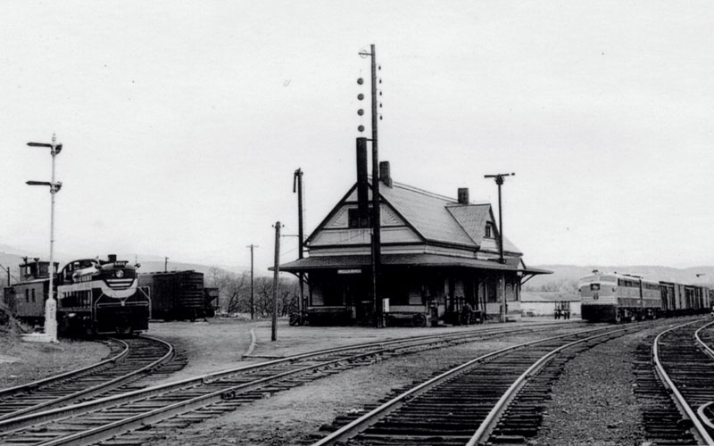
Wells River Depot in 1952. Four different tracks joined here in a "Wye" around the depot building. Photographer is north of the building looking south, with train on right coming up from White River Junction and the one on the left coming over from Woodsville. Photo: Dwight Smith
South Ryegate. The river always wins.
The trail continues on the railbed into Ryegate, on a section of the bed which was converted into a simple gravel town road in the 1990s. This is Brown Drive. At the intersection with Route 302 you can see where the railroad proceeded straight across the river into the village. There are several old stone bridge abutments. The depot was just beyond this bridge. Along with numerous businesses that relied on the trains including stone carving sheds and a creamery.
The tracks ran along the river through the village, and the railroad company waged a battle with the river for many years. They even straightened the river to reduce the number of bridges needed to cross its meanders. But in the end the railbed in the center of the village is mostly gone, and the river remains.
On to Boltonville, Newbury and into Wells River Village.
Beyond the village across the rest of Rygate and then into the Town of Newbury and finally Wells River there are numerous scattered remains of the railbed. Most of them are not connected enough to be a trail at this time. Except for a nice two mile section of railbed that starts at "Boltonville Landing" and runs above the river past several scenic properties conserved as natural areas and farms. This ends on the shoulder of Route 302 a little ways east of I-91. Saving this section of railbed was one of the first big projects for CVTA years ago.
Finally the last leg of the Cross Vermont Trail route descends into Wells River on Route 302. The railroad meanwhile used to run off to the side of the highway along the river. In those days the Montpelier and Wells River tracks finally ended at a junction with several other railroads at the depot on the hill above downtown, just east of Route 5 overlooking the bridge to New Hampshire.
So we blow the whistle one more time for the memory of the Montpelier & Wells River Railroad.
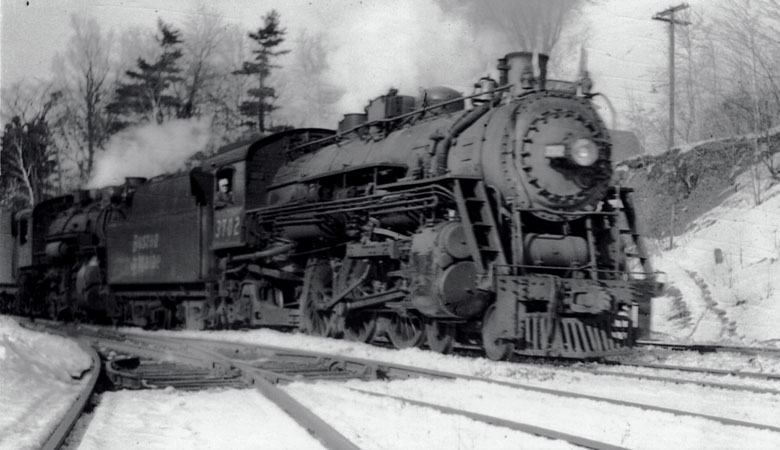
Doubleheader on a freight train, February 1947. Photo: Dwight Smith.
Arriving at the multi track junction by the Wells River Depot.
Bought, Abandoned, Broken Up
History of the ownership of the old railbed.
Important - it's not a railroad anymore. It's not "railbanked". There is no lingering public right of way left over from the railroad days. Nothing like that.
Today the former Montpelier & Wells River Railroad is just an old railbed whose ownership has broken up over the years to many dozens of different individuals and entities.
This matters for the trail because it means that the work of the Cross Vermont Trail Association is to collaborate with the current landowners, one by one as they may be interested to do so, to see if we can save portions of the railbed as a public trail. And where that is not possible our job is to instead work with landowners to see if there is a way we can build new trail to reconnect the route some other way.
The difference between "banking" and "abandoning".
Railroads are a special thing under federal law. Summarizing greatly it's safe to say that railroads were very important in the 19th century and so government spent a lot of energy to promote and regulate them as a public good. One result of that history is that even if a railroad is a private business it cannot simply decide on its own to stop being a railroad. It has to petition the federal government for permission to "abandon" legal classification as a railroad.
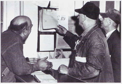
Last Train. "It was a sad occasion on November 15, 1956, as general manager Charles Morrell, conductor John Spaulding, and brakeman Calvin Richards checked the bulletins at the Montpelier depot prior to the last run to Wells River."
Photo: Sky Route/Gove
The abandonment may be allowed. In which case all those laws about the public interest go away. And where the tracks ran simply becomes land like any other, no longer legally a railroad (even if still physically looking like an old railbed.)
Or the petition to abandon may be denied. When that happens the original hope is that a new owner will be found who can continue to run the railroad. Sometimes, though, new owners cannot make use of all the old tracks and in places the operation simply stops and portions of old beds go unmaintained while still being legally railroads (and still subject to all those special laws about public rights.) This explains why there are "railroads" some places in Vermont, including in Montpelier, that appear completely discontinued, with trees growing through the rails, but which are still officially railroads.
In response to the desire for a middle ground between full abandonment and full profitable operation with trains to save rail corridors, a third option was created in the 1980s, railbanking. In this compromise approach the bed is "banked" by conversion to some other public use, usually a trail. This saves the corridor as a unified property that would still be available in the future to carry trains again if there is ever a need.
A lot of railroads have now been banked. There are thousands of miles of rail trail in the US. The Rails to Trails Conservancy is a national organization dedicated to this idea. (They've got a great website here.) In Vermont probably the best example of railbanking is the Lamoille Valley Rail Trail. It still legally has railroad status, and is administered by the Vermont Agency of Transportation, though currently as a trail.
None of the old Montpelier & Wells River is railbanked. Some of it is still an operating railroad. Most of it was abandoned long ago.
The Montpelier & Wells River Railroad petitioned for abandonment in the late 1950s.
And the story becomes twisty.
The company that owned our railroad (the name had changed by then, that's not important here) petitioned the federal Interstate Commerce Commission for abandonment in the late 1950s.
It was partially granted. This is the first twist in the story.
The petition was denied for the portion of the rail line between Montpelier and Barre. A new owner was found who ran it as a private business until the 1970s. After that the State bought the active railroad and it is now owned by the Vermont Agency of Transportation and leased from the State by the Vermont Rail System, a private company. They use it to carry freight, mostly granite from Quarry Hill in Barre Town. It is not uncommon to see the cars slow rolling through Barre and Montpelier loaded with giant blocks of stone.
But the petition for the majority of the main line, all the way out to Wells River, was granted. The abandonment begins exactly at Gallison Hill Road in Montpelier (near the Central Vermont Civic Center, the ice rink) and goes all the way to Wells River Village, where the tracks junctioned with a north-south line in the village just east of Route 5. (Meanwhile, that north south line through Wells River is still an active railroad, also owned by the State of Vermont and leased to Vermont Rail System.)
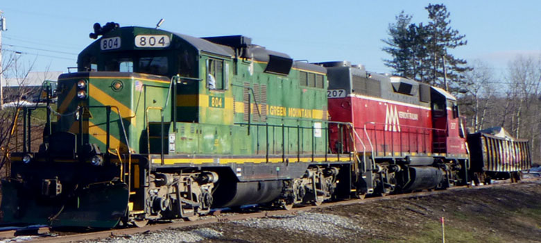
Vermont Rail System locomotives hook up to a car piled high with granite blocks, 2019. Photo: CVTA
This is on the actual tracks that long ago went to Wells River, but which now dead end at Gallison Hill Road and are used as a siding.
After being abandoned, the Montpelier & Wells River reverted to private ownership.
But the private owner was the railroad company.
The railroad company owned the land outright, "in fee". The place that the trains ran is traditionally called a "right of way" - but in the case of the Montpelier & Wells River Railroad that is not technically correct. Way back at the beginning, in the early 1870s, the railroad company simply bought and assembled a long skinny piece of property, which they fully owned. (A right-of-way means you own the permission to cross someone else's land, but they still own the land themselves. This is different.)
So this means that after abandonment the railbed reverted to private ownership, but the owner was just the railroad company.
Of course the railroad company was bankrupt in the late 1950s and they were looking to cash out. First they stripped the rails and other material they could salvage for sale. And then they went looking for a buyer for the land itself. They found one - the State of Vermont bought the entire old railbed in 1957. And then the State simply owned it as a long skinny piece of property - at that time it was not a railroad, or a road, or any other thing, just land.
"Scrapper train. Tearing up the rails near So. Ryegate VT, March 1957" Photo: Dwight Smith
State of Vermont bought the railbed lock stock and barrel in the 1950s.
But then gave a lot of it away piece by piece over the years.
Why did the State buy the railbed? Not to make a trail, not in the 1950s, that's obvious. Even though we have talked to people who were kids around here at that time, and they report that it wasn't long before some were going out onto the railbed like it was a trail.
- "My brother in law was a dairy farmer and he liked to go jogging back then. He was out on the bed as soon as the tracks were pulled."
- "I am very familiar with the old railbed. My dad would take me out here pheasant hunting."
- "I grew up in Plainfield and we would ride our bikes on the bed to the Checkerboard Store on Rte 14 because they had the best baseball cards."
Last but not least by the late 1960s snowmobile clubs started to work to maintain the railbed for use as a winter trail. On long sections of the railbed this continues today. These clubs worked with private landowners as well as the State, though, and so it didn't seem to result in the railbed being kept in specifically public ownership. (And besides, it was already too late for that by the late 60s, since much what has been sold or given away was done earlier.)
We would love to hear more from folks who remember those days. Or maybe there are archive documents somewhere that can shed light on what the State people were thinking then.
In the meantime, it seems basically obvious that initially the State bought the railbed because it might be useful as a road - either as land for the expansion of adjacent highways, or by itself as an access road to public forests. It looks like the idea was State agencies would take what they needed, and the rest would be kept in reserve as "surplus property" or disposed of when convenient. That seems to have been the logic back then.
Based on that logic, in some places the old railbed property disappeared into highway expansion projects, on Rte 2, 232 and 302. And in Groton State Forest the railbed was saved for a variety of public uses. Outside of those places, over the years, mostly between the late 1950s and late 1980s (but as recently as 2012!), the State has sold or given away most of the rest of the railbed piecemeal to a variety of private or municipal owners.
Once portions of the railbed were sold or given away by the State, they were generally combined with the existing property of the recipients. At this point, the portions of the railbed entered the land records like any other properties and ownership can be traced in the normal way. Of course old land records still have perplexities for which modern professionals - such as lawyers and surveyors - are needed to sort out. But it becomes normal lands record research (and is no longer tangled up in "railroad history".)
This all adds up to the current jig saw puzzle of ownership of the old railbed.
A thumbnail outline of current ownerships along the old railbed.
Hey did we mention it's a twisty story? This is compiled from many conversations over the years, and hours in town land records, and so on. We are always gathering new informaion and trying to understand the old railbed better.
Give us a call if you have thoughts or additional information to share!
- Downtown Montpelier to Gallison Hill Road. This is still an active railroad. The Montpelier Bike Path runs alongside the tracks as a "Rail With Trail."
- Gallison Hill Road to the Winooski River Bridge. Now owned by utility companies and used as access road to hydro power dam. The owners have granted permanent public trail easement to CVTA. This is open as a trail now.
- Winooski River Bridge (East Montpelier - Berlin Town Line) to just a little bit east of Muddy Brook Road in East Montpelier. This is still owned by the State and the railbed is gone, buried under an expansion of Route 2 in the early 1960s. CVTA is working now on an active construction project, with the permission of the State, to build a new trail alongside the highway, in the space between the highway and the river.
- A little bit east of Muddy Brook Road in East Montpelier to Country Club Road in Plainfield. All of this section of the bed was sold off by the State in the 1960s. Today CVTA has permission from all of the current landowners to build and operate a trail along the corridor. Most of these permissions are in the form of permanent public trail easements. West of Route 14 we are actively working now to build the trail and hope to get open by 2026. East of Route 14 the trail on the railbed has been open since the 1990s.
- Between Country Club Road in Plainfield and Plainfield Village the railbed is mostly gone due to natural causes (floods and mud slides.) The State sold off ownership through here decades ago and it is all private, though CVTA has repurchased some sections of it more recently. Over the long term CVTA is interested to work with our neighboring private landowners to see if it is possible to build a new trail that would connect to the village from the west.
- Between Plainfield Village and John Fowler Road in Marshfield the railbed is now owned for a length by the Town of Plainfield (at the Park and Ride) and then by a private landowner. CVTA has permission from both these landowners and this section of the railbed is open as a trail.
- Between John Fowler Road and Bemis Farm Road in Marshfield the railbed is privately owned and not a public trail. The State sold or gave away ownership all along here to many abutting landowners mostly in the early 1960s. Since then these many little pieces of ownership have been sold on, subdivided or combined in all the various ways that normally happens to property over time. But the railbed itself is still mostly there. Much of it has long been a snowmobile trail. Some landowners use it as a forest road. CVTA is interested to help save the railbed basically like it is now, working together with any landowners who are interested in allowing four season non motorized public use, shared with their own use whatever that may be. Give us a call to talk more!
- Between Bemis Farm Road and the boundary of Groton State Forest (near Marshfield Pond) the railbed is now a Marshfield Town Road. It's a "Class IV" road, minimally maintained by the town. It is the Cross Vermont Trail. And also is the access road to several camps and houses, as well as to agricultural land.
- Groton State Forest (Marshfield Pond to Ricker Pond). It's a rail trail here and a part of the State Forest recreation trail network. In the early 1990s the Cross Vermont Trail Association was formed with the idea to save the old railbed as a trail, and an early achievement was the designation of the bed here as a trail (and not just a forest road). (Note there are some private inholdings along the railbed where the State does not own it for short distances. All of these landowners have long allowed the current sort of public use. Thank you all!) The railbed is maintained to allow use by motor vehicles for land management and other reasons, though much of it is gated.
- Town of Groton from Ricker Pond to Pine Mt. In the early 1980s the State gave the railbed south of the State Forest to the Town of Groton who has maintained it ever since as a public trail for snowmobiles and four season non motorized use. In summer autos may use portions of it (but it is not a town road.)
- Town of Ryegate from Pine Mt to Route 302 (aka Brown Drive). Also in the early 1980s the State gave this section of the railbed to the Town of Ryegate. Here the town has converted the railbed to a town road. It's a quiet road that basically serves just one property (a conserved farm). It is also the Cross Vermont Trail.
- South Ryegate Village to Boltonville in Newbury. Here the railbed is mostly gone, due to lost bridges and the meandering of the river. There are odds and ends remaining though. Some were sold off by the State in the 1980s, while others remain public. Over the long term, CVTA is interested to work with all the various landowners to see if it can be possible to make a new off road trail.
- Boltonville to just east of Blue Mountain Union School. Here is a two mile section of the railbed, still owned the State. CVTA took the lead in rehabilitating this section in the early 2000s and opening it as a public trail. This involved building an underpass uner I-91, our first big project! First of many.
- From Route 302 just east of Blue Mt Union School into Wells River Village. Some of the railbed here is disappeared under an expansion of Route 302, and much of the remainder has been sold off by the State over the years. But there may be a way to recreate a trail along the general route, and CVTA is interested to continue talking with current landowners to see what might be possible.
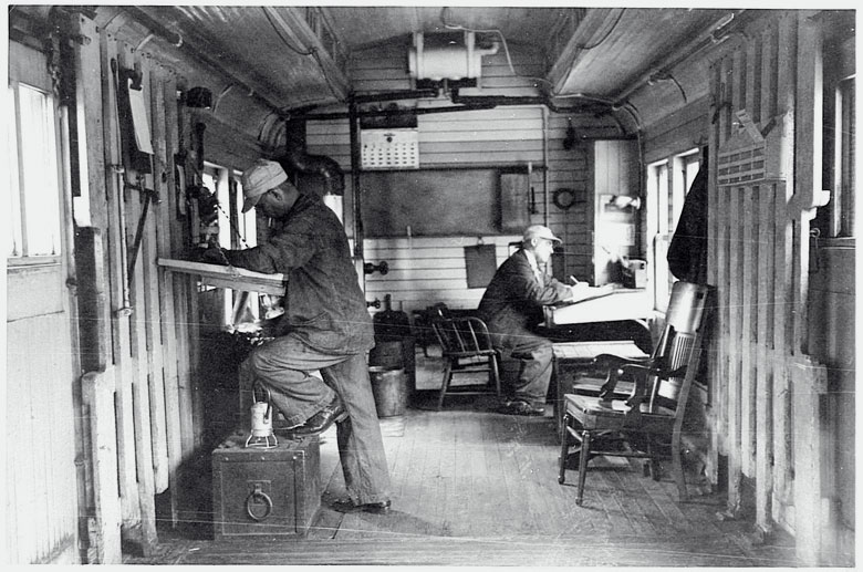
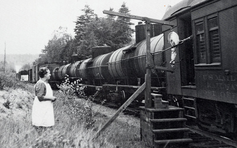
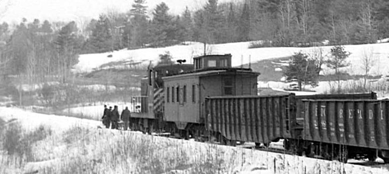
At work inside the combination car, 1953. On the daily run from Montpelier to Wells River. Photo: Dwight Smith
Reference Books
Vermont's Granite Railroads
Robert C. Jones, Whitney J. Maxfield, William G. Gove
Pruett Publishing Company
1985
ISBN 0-87108-695-6
Sky Route to the Quarries
Bill Gove
Quarry View Publishing
2004
ISBN 1-931271-12-7
Lost Railroads of New England
Ronald Dale Karr
Branch Line Press
2010
ISBN 978-0-942147-11-7
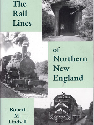
The Rail Lines of Northern New England
Robert. M. Lindsell
Branch Line Press
2000
ISBN 0-942147-06-5