(The science and history of the Boltonville section of the Wells River watershed)
Project description
Schedule
Stations & Data
Photo Gallery
Farms & Rivers
CVTA Home Page
MAPS
& PHOTOS
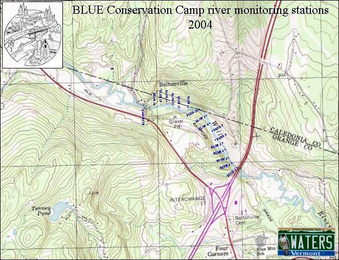
- Topo
map of monitoring stations:
- Click on the map to the right to view a larger version in a separate browser window. (JPEG, 119K)
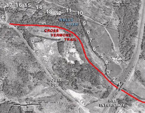
- Aerial
photo of monitoring stations:
- Click on the image to the right to view a larger version in a separate browser window. (JPEG, 538K)
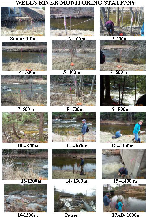
- Photos
of monitoring stations:
- Click on the image to the right to view a larger version in a separate browser window. (JPEG, 133K)
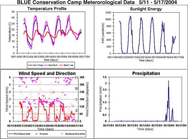
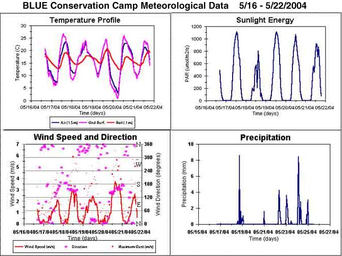
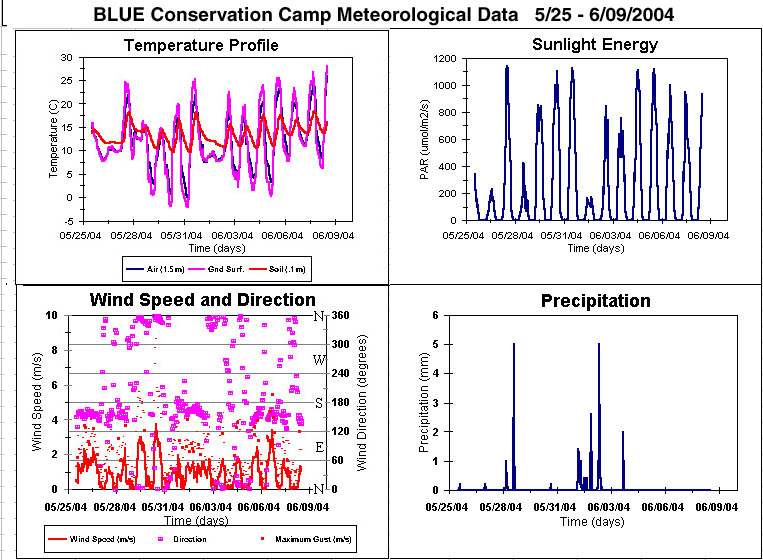
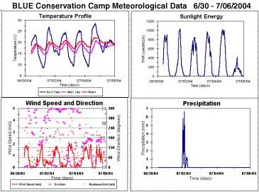
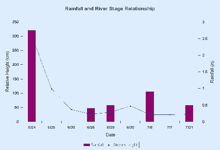
METEOROLOGICAL
DATA
(Click on image to view larger version in separate window)
(Click on image to view larger version in separate window)

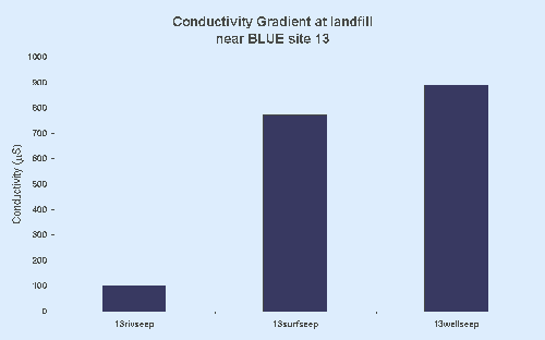
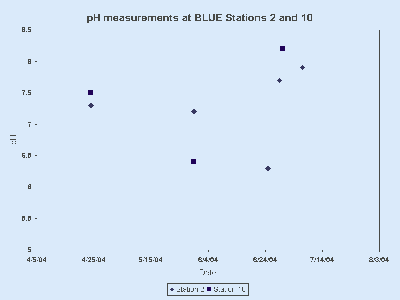
OTHER
STATION
DATA
(Click on image to view larger version in separate window)
(Click on image to view larger version in separate window)
TABLES
AND EXCEL FILES
(Click on each link to download and view in separate window)
(Click on each link to download and view in separate window)
BLUE Datasheet (July 2004, Microsoft Excel Worksheet, 39KB)
BLUE Metadata (July 2004, Microsoft Excel Worksheet, 250KB)
Station 2 May 16-25 (May 2004, Microsoft Excel Worksheet, 36KB)
Station 10 Apr24-May25 (May 2004, Microsoft Excel Worksheet, 76KB)
Stations 2 & 10 Compared (April 24 - May 30, 2004, Microsoft Excel Worksheet, 144KB)
BLUE
is funded by a Vermont Watershed Grant and supported by
the White River Natural Resources Conservation District.
the White River Natural Resources Conservation District.